
Maps of Long Valley Caldera and Mono-Inyo Craters Volcanic Chain, California
Geologic maps
- Digital Geologic Map of Long Valley Caldera and the Mono-Inyo Craters volcanic chain - Bailey, R.A., 1989 (scale 1:62,500) this map is out of print and only available in digital format
- Simplified geologic map
Volcano-hazard zone maps
- Tephra fall, Long Valley area
- Pyroclastic flows, Mono-Inyo Craters Volcanic Chain
- Pyroclastic flows, south moat area
- Principal air routes above 18,000 ft.
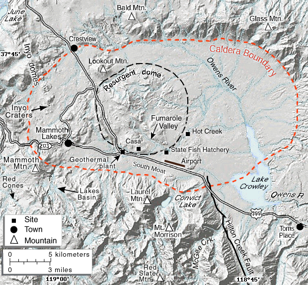
Shaded-relief maps
- Long Valley Caldera, 420 x 320 pixels; 133 KB
- Long Valley Caldera, 620 x 574 pixels; 284 KB
- Inyo Craters (unlabled), 235 x 443 pixels; 52 KB
Inyo Craters
- Location map, 7 KB
- Fissures near Inyo Craters, 25 KB
Selected Features
- Hydrologic features in Long Valley Caldera, 25 KB
- Simplified area map
- Recent eruptions along Mono-Inyo Craters Volcanic Chain
- Tree-kill areas near Mammoth Mountain
