Data and Tools
BRS produces tools, models, data and metadata to help agricultural, fisheries and forestry industries make decisions.

Australian Natural Resources Data Library
Find and download data on a variety of natural resource subjects.

Rainfall to Pasture Growth Outlook Tool
Access rainfall, soil moisture and pasture growth information to make more accurate grazing decisions.

2008 Country Matters – Social Atlas of Rural and Regional Australia
allows users to create a tailored report, generating maps on population changes, employment and industry, education, income, access to services and many other characteristics.

Matters for Target
Information about natural resource management themes and associated issues. National Coordination Committees, Attributes required to analyse impact, and Available Data collections.

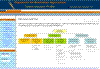
Multi-Criteria Analysis Shell - MCAS-S Versions 1
MCAS-S is a user-friendly tool that allows decision-makers to analyse and compare complex spatial information without the need for specialised training or technical support.

Atlas of Australian Marine Fishing and Coastal Communities
This atlas focuses on mapping and analysis of Australian wild capture commercial and Indigenous fisheries and their endangered coastal communities.

Rural Water
Water information for policy makers and resource planners - online and at your fingertips.

Connected Water
Provides a toolkit of practical methods for assessing the connectivity of water resources in a river catchment area. Gain information on management and policy options useful in taking an integrated approach to managing water resources.

Integrated Vegetation Online
See the distribution of major vegetation cover types in Australia, includes native forests and grasslands and non-native vegetation.

Land Use Mapping For Australia
Catchment scale coverage for Australia with links to enable viewing of maps and access to datasets.

Plantation Information Network
Access studies identifying land suitable for commercial timber plantations.

Rainfall Reliability Wizard
Using data since January 1900, estimate: rainfall reliability,rainfall means, and rainfall variability.
Grains Industry Profile
Access information on how the grains industry contributes to a range of environmental, economic and social outcomes.