| Saturday February 28, 2009 | Accessibility help | Text only | Print | Send to a friend | Make this my homepage | Contact Us | Help |
| ||||||
Country Guide | |||||

|
|
||||
|
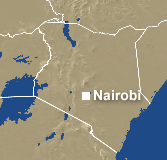
Kenya is a country about as large as France and situated in East Africa between 5°N and 5°S. It has a very diverse relief with a low coastal plain on the Indian Ocean shore, extensive inland plateaux regions between 915 m/3,000 ft and 1,500 m/5,000 ft and several mountain ranges and isolated peaks such as Mount Kenya, which rises to 5,200 m/17,000 ft and has a permanent snow-cap. It is bordered on the north by Ethiopia and Somalia, on the south by Tanzania, and on the west by Uganda and the shores of Lake Victoria. Although Kenya lies athwart the equator, annual rainfall over most of the country is surprisingly low and rather variable from year to year. This is because the intertropical belt of cloud and rain passes rather quickly across Kenya in April and October and because the predominant seasonal winds, the north and south monsoons as they are called in East Africa, have a track parallel to the coast and have already passed over large areas of land before reaching Kenya. Temperatures over much of Kenya are subtropical or temperate, because of the reduction of temperature with altitude, and are similar to those in California, summer in France or southern Britain rather than those elsewhere in equatorial Africa. Only the coastal lowlands experience the constant high temperatures and humidity associated with equatorial latitudes. Even here they are less oppressive than one might expect, because of the regular daytime sea breezes and longer hours of sunshine. It is not surprising that with such a favourable climate - sunny, only moderately wet, and not too hot - and a great variety of scenery, wild life, game parks, and good communications, Kenya has many attractions for the tourist. The variety of relief and the range of altitude in Kenya produce a considerable number of distinctive local climates and local weather too numerous to be detailed here. The country can be divided broadly into four climatic regions, each with certain features of equatorial climates. There is a double rainy season between March and May and between November and December, with two intervening dry seasons. There is a small difference in temperature from month to month through the year. Both these features can be seen in the three tables for Kenya included here. The four climatic regions are: The Coastal Region Temperatures remain quite high around the year as does humidity; but the weather is less oppressive than might be thought because of the regular and strong onshore winds in the daytime and the greater number of sunshine hours which average seven to eight a day in all months. The weather, however, can feel sultry, particularly at night. The table for Mombasa is representative of this region. The Northern Frontier Districts and the Lower Inland Plateau In the lower districts temperatures are high round the year, there is much sunshine, and the region is a typical hot desert like the adjoining southern parts of Somalia and Ethiopia. Humidity is low and, apart from occasional excessive heat, it is a healthy climate. The Kenya Highlands There is a double rainy season but rainfall is moderate and only exceeds 1,250 mm/50 in a year on the higher parts. Over most of the region the sunniest time of the year is from December to March. The cloudiest period is from June to September when there is much drizzle but little heavy rain. This period is often called 'winter' in the Kenya Highlands and the evenings may feel chilly compared with the sunnier months. The table for Nairobi is representative of much of the region. The table for Kisumu on the shores of Lake Victoria, which is virtually an inland sea, shows that there is rather more rainfall in each month here. This is a consequence of the greater humidity picked up by winds crossing the lake and a liability for thunderstorms to break out during the night. The higher mountain regions | |||||
About the BBC | Help | Terms of Use | Privacy & Cookies Policy |