Satellite Image of Canada
Full-Colour | Monochrome
Full-Colour Satellite Image

This digital mosaic of Canada, produced by Natural Resources Canada (Canada
Centre for Remote Sensing), is a composite of individual satellite images.
The colours reflect differences in the density of vegetation cover: bright
green for dense vegetation in the humid southern regions; yellow for semi-arid
and mountainous regions; brown for the far north where vegetation cover
is very sparse; and white for the Arctic regions.
Monochrome Satellite Image
 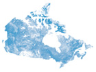
This digital mosaic of Canada, produced by Natural Resources Canada
(Canada Centre for Remote Sensing), is a composite of individual satellite
images. The differences in the density of vegetation are illustrated through
shading.
|

